 Ventura (2009):
 One of the original California Mission settlements, the City of San Buenaventura (aka Ventura) is a city blessed with a great locale and an enviable climate, and for most of its history has been a model of good, mixed-use, walkable and sustainable urbanism. Nevertheless, Ventura has not been immune to the social, cultural and economic pressures of post-1945 sprawl development. Ventura’s stunning topography has also in recent decades worked against it, as both a freeway and at-grade railroad tracks converge at the city’s narrowest point between its mountains and the ocean to effectively cut Ventura’s historic center off from its estimable beachfront. In the years immediately prior to our visit Ventura had adopted both a new-form-based code and their
Downtown Specific Plan; and the work ultimately presented by Notre Dame students to the city as
2009 Ventura Vision was undertaken to both ameliorate Ventura’s significant existing infrastructure challenges and to test and confirm the City’s new form-based code by means of a variety of new infill projects. Notre Dame’s multiple proposals had the cumulative effect of better connecting Ventura’s historic center to The Beach and to County Fairgrounds, better managing parking supply and demand, improving public transit, preserving and enhancing Ventura’s historic architectural character, promoting additional housing development in the historic center, improving existing infrastructure and creating new infrastructure to meet anticipated development requirements.
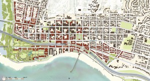
Ventura Historic Center Existing Conditions
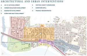
Historic Center Proposed Interventions
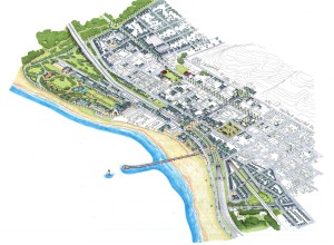
Aerial view of proposed interventions
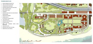
Ventura County Fairgrounds Proposed Interventions
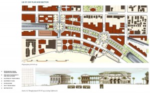
Proposed US-101 Cap Plan and Section
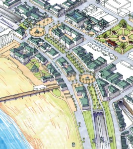
Aerial view of proposed US-101 Cap
Perspective view from northbound US-101
 Ventura (2009): One of the original California Mission settlements, the City of San Buenaventura (aka Ventura) is a city blessed with a great locale and an enviable climate, and for most of its history has been a model of good, mixed-use, walkable and sustainable urbanism. Nevertheless, Ventura has not been immune to the social, cultural and economic pressures of post-1945 sprawl development. Ventura’s stunning topography has also in recent decades worked against it, as both a freeway and at-grade railroad tracks converge at the city’s narrowest point between its mountains and the ocean to effectively cut Ventura’s historic center off from its estimable beachfront. In the years immediately prior to our visit Ventura had adopted both a new-form-based code and their Downtown Specific Plan; and the work ultimately presented by Notre Dame students to the city as 2009 Ventura Vision was undertaken to both ameliorate Ventura’s significant existing infrastructure challenges and to test and confirm the City’s new form-based code by means of a variety of new infill projects. Notre Dame’s multiple proposals had the cumulative effect of better connecting Ventura’s historic center to The Beach and to County Fairgrounds, better managing parking supply and demand, improving public transit, preserving and enhancing Ventura’s historic architectural character, promoting additional housing development in the historic center, improving existing infrastructure and creating new infrastructure to meet anticipated development requirements.
 Ventura (2009): One of the original California Mission settlements, the City of San Buenaventura (aka Ventura) is a city blessed with a great locale and an enviable climate, and for most of its history has been a model of good, mixed-use, walkable and sustainable urbanism. Nevertheless, Ventura has not been immune to the social, cultural and economic pressures of post-1945 sprawl development. Ventura’s stunning topography has also in recent decades worked against it, as both a freeway and at-grade railroad tracks converge at the city’s narrowest point between its mountains and the ocean to effectively cut Ventura’s historic center off from its estimable beachfront. In the years immediately prior to our visit Ventura had adopted both a new-form-based code and their Downtown Specific Plan; and the work ultimately presented by Notre Dame students to the city as 2009 Ventura Vision was undertaken to both ameliorate Ventura’s significant existing infrastructure challenges and to test and confirm the City’s new form-based code by means of a variety of new infill projects. Notre Dame’s multiple proposals had the cumulative effect of better connecting Ventura’s historic center to The Beach and to County Fairgrounds, better managing parking supply and demand, improving public transit, preserving and enhancing Ventura’s historic architectural character, promoting additional housing development in the historic center, improving existing infrastructure and creating new infrastructure to meet anticipated development requirements.
